


5 out of 5

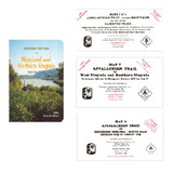
National Geographic 603316 Appalachian Trail: Springer Mountain To Davenport Gap No.1501
* Click "Add to Cart" to calculate shipping and delivery time.
Product Description
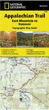
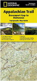
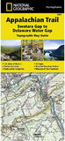
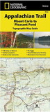
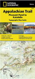
The Springer Mountain to Davenport Gap Topographic Map Guidemakes a perfect traveling companion when traversing the Georgia, southeastern Tennessee and southwestern North Carolina, section of the Appalachian Trail (A.T.). The southern most section of the A.T. which starts at Georgia's Springer Mountain and heads north into North Carolina and Tennessee, offers some of most physically challenging, but rewarding hiking along the entire trail. The A.T. through this area is located entirely within National Park and National Forest land, and follows the ridges and balds of the beautiful and biologically diverse Southern Appalachians.
The map and trail profile provide a step by step visual guide to hiking the trail, mile by rugged mile. The Topographic Map Guide is built for all levels of hiking enthusiasts, from the day tripper to the multi month 'thru-hiker'. The front pages of the printed Topographic Map Guide include resupply information, town inset maps, camping options, and much more.
Other features found on this map include: A. Rufus Morgan Shelter, Blood Mountain, Blood Mountain Shelter, Blue Mountain Shelter, Bly Gap, Brown Fork Gap Shelter, Cable Gap Shelter, Carter Gap Shelter, Chattahoochee National Forest, Clayton, Clingmans Dome, Cold Spring Shelter, Cosby Knob Shelter, Davenport Gap Shelter, Deep Gap Shelter, Derrick Knob Shelter, Dicks Creek Gap, Double Spring Gap Shelter, Fontana Dam Shelter, Fontana Lake, Franklin, Gooch Mountain Shelter, Great Smoky Mountains National Park, Hawk Mountain Shelter, Helen, Icewater Spring Shelter, Long Branch Shelter, Low Gap Shelter, Mollies Ridge Shelter, Mount Collins Shelter, Mount Guyot, Muskrat Creek Shelter, Nantahala National Forest, Newfound Gap, Peck's Corner Shelter, Plumorchard Gap Shelter, Rock Gap Shelter, Russell Field Shelter, Sassafras Gap Shelter, Siler Bald Shelter, Silers Bald Shelter, Spence Field Shelter, Springer Mountain, Springer Mountain Shelter, Standing Indian Shelter, Stover Creek Shelter, Suches, Tray Mountain Shelter, Tri-Corner Knob Shelter, Wayah Bald, Wayah Shelter, Wesser Bald Shelter, Whitley Gap Shelter, Woods Hole Shelter..
 Attention CA Residents: Prop 65 Warning
WARNING:
This product can expose you to chemicals which are known to the State of California to cause cancer, birth defects, or other reproductive harm. For more information, go to www.p65warnings.ca.gov.
Need more information?
Our staff are available to answer any questions you may have about this item
Our staff are available to answer any questions you may have about this item
Customer Reviews
By CrzPrz
Date: June 06, 2018
Great resource!!
Rating:  [5 of 5 Stars!]
[5 of 5 Stars!]
By pondguy
Date: March 18, 2018
Probably just my comfort with fold out maps over this book style. Didn't work well for my style navigating.
Rating:  [3 of 5 Stars!]
[3 of 5 Stars!]
By Christian K
Date: March 04, 2018
Love how it’s spread out into bite sized sections making it easy to read and navigate. Decently water resistant thanks to the coating on the pages but, with section hiking and constant use it does eventually get a bit water laden.
Rating: [5 of 5 Stars!]
[5 of 5 Stars!]
By Rooty
Date: October 30, 2017
Well made and the layout is good. Handily fits in a pant pocket. Good detail. A book style map is a great idea for a trail like the Appalachian Trail.
Rating: [5 of 5 Stars!]
[5 of 5 Stars!]
By Dennylinda50
Date: September 22, 2017
Great detail. Sturdy construction
Rating: [5 of 5 Stars!]
[5 of 5 Stars!]
By Mr. Edward C. Muckerman
Date: July 26, 2017
This map was okay - it got rained on for 3 days and held up. I would have preferred to see more elevation gains and more narrative. Part of the AT requires you to have a bear cannister and there was no mention of that in this guide.
Rating: [5 of 5 Stars!]
[5 of 5 Stars!]